人はなぜ、Googleマップを利用するのでしょうか?
....... 一般的には、目的地までの検索と ナビゲーションが 多いかと思います。
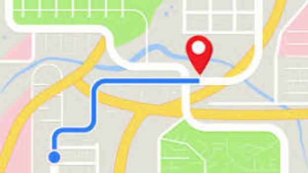
初めて行く場所への最適なルート(車、公共交通機関、徒歩、自転車など)を知りたいとき ですね。
私は、カーナビよりも Googleマップを利用することが多いかもしれません。
それから、電車やバスの乗り換え案内や運行状況、時刻表を確認したいときにも 便利です。
あと、「ここは、どこ?」と思ったときに、自分が今どこにいるのか 現在地を確認したいときにも 利用できますね。
そして、待ち合わせの相手に 自分のリアルタイムの位置を 共有したい時なども使えます。
旅行先や外出先で、近くの飲食店(ラーメン🍜、カフェなど)、コンビニ🏪、ガソリンスタンド、駐車場🅿、ATM、トイレ🚾 などを探したい場合には、とても重宝しますよね。
”最寄りの” と付けて、カフェ☕ や ガソリンスタンド⛽ などを 探すことも あるでしょう。
そして、よく使われるのは、お店や観光スポットの営業時間、電話番号、ウェブサイトを確認したいときですね。
お店のリアルタイムの混雑状況も確認でき、ピークタイムを避けたいときにも利用できます。
実際に訪れた人の口コミ(レビュー)も、とても参考になります。
投稿された写真を見ると、評価や雰囲気を知ることができますよね。
行くか行かないかを 決定できてしまいます。
紙の地図を見ながらの運転を 体験したことがある私は、ホントに便利に なったものだと実感してしまいます........
Googleマップは非常に多機能で、日常生活から旅行、ビジネスに至るまで、様々な シチュエーションで利用されているので、他にもいろいろ使い方があります☺
旅行先で訪れたい場所や、また行きたいお店などを「リスト」として保存して、友人や家族と共有したいときにも、使えます。
それから、特定のスポットやルートを整理して、オリジナルの地図(マイマップ)を作成することもできちゃいます。
Googleマップは、屋内にも使えるので、大きな空港、デパート、駅など、施設内のフロアマップ(インドアマップ)を確認して、目的の場所(店舗、改札、出口など)を探すことだってできます。
それから、大きなショッピングモールなどで、自分が 車を駐車した場所が 分からなくなったことは ありませんか?
私はたま~にあるのですが、車の駐車位置を保存して、戻るときに迷わないようにも 使えるんです。
また、「タイムライン」機能を 利用すると 過去に訪れた場所や通ったルートを振り返ることも 可能です。
ああ、なんて便利なんでしょうか、Googleマップ って.........
そしてそして、Googleマップを オフラインで 利用したことがある方も いらっしゃるでしょう。
電波の届きにくい場所や海外旅行などで、事前に地図をダウンロードしておいて、インターネット接続なしで 地図や ルート検索 できちゃうんですよね。
.....このオフライン機能は、日本では 2019年頃から開始されたのですが、世界的には かなり前から存在していたそうです。
なぜなのか?
これは、Googleマップが 日本向けの地図データを ゼンリン製から自社製に切り替えたことが 関係しているようです。
たくさんの機能が増えて、どんどん便利になっていますが、私は、先日アメリカの Googleマップをツラツラと 見ていて、「イマーシブビュー」というのを見つけました。
iPhone で、アメリカの遊園地 (ディズニーランド、ナッツベリーファームなど) を開いてみた時に、掲載写真や画像の配置が何となくいつもと 違うなぁ、と感じたのですが、よく見ると いちばん 目立つ位置に、3Dマップが載っていたのです。
確かに、ディズニーランドのような広い場所は、これを見ると一目瞭然で とっても分かりやすいですね。何となく、ドローンから見ているような感じもします。
アメリカが全部このような表示になっているわけではなくて、今のところ、ごく限られた ディズニーランドのような有名な場所だけのようです。
気になって日本のディズニーランドも 確認したところ、なんと!日本のディズニーランドも イマーシブビューが 掲載されておりました。
しかし、私が見た限りではディズニーランドくらいで、他の遊園地、USJなども、通常の表示のしかたで、ふつうに画像が掲載されていました。
新しい機能「イマーシブビュー」は、まだ黎明期 のようです ☺
Why do people use Google Maps?
.......Generally, most people use it to search for and navigate to their destination.
When you're going somewhere for the first time and want to know the best route (by car, public transportation, walking, bicycle, etc.), you might use Google Maps more than your car navigation system.
It's also useful when you want to check train and bus transfer information, service status, and timetables.
You can also use it when you find yourself wondering, "Where am I?" and want to check your current location.
You can also use it when you want to share your real-time location with someone you're meeting up with.
It's very useful when you're traveling or out and about and want to find nearby restaurants (ramen 🍜, cafes, etc.), convenience stores 🏪, gas stations, parking lots 🅿, ATMs, restrooms 🚾, etc.
You might also add "nearest" to search for things like cafes ☕ or gas stations ⛽.
Another common use is when you want to check the opening hours, phone numbers, and websites of shops and tourist attractions.
You can also check the real-time occupancy status of shops, which is useful when you want to avoid peak times.
Reviews from people who have actually visited the place are also very helpful.
Looking at the posted photos, you can get a sense of the place's reputation and atmosphere.
It can really help you decide whether to go or not.
Having experienced driving while looking at a paper map, I can truly say how convenient it is...
Google Maps is incredibly versatile and is used in a variety of situations, from everyday life to travel and business, so there are many other ways to use it. ☺
You can also save lists of places you want to visit while traveling or shops you want to visit again, and share them with friends and family.
You can also create your own original maps (My Maps) by organizing specific spots and routes.
Google Maps can also be used indoors, so you can check the floor map (indoor map) of facilities like large airports, department stores, and train stations to find your destination (stores, ticket gates, exits, etc.).
Also, have you ever lost track of where you parked your car at a large shopping mall?
It happens to me every now and then, and you can save your parking location to avoid getting lost when you're heading back.
You can also use the "Timeline" feature to look back at places you've visited and routes you've taken in the past.
Oh, how convenient Google Maps is...
And, some of you may have used Google Maps offline.
When you're in a place with poor signal reception or traveling abroad, you can download maps in advance and search for maps and routes without an internet connection.
This offline feature was launched in Japan around 2019, but it has apparently been available globally for quite some time.
Why?
This appears to be related to Google Maps switching from Zenrin's map data for Japan to its own.
Many new features have been added, making the service increasingly convenient, but the other day I was browsing Google Maps in the US and came across something called "Immersive View."
When I opened a US amusement park (Disneyland, Knott's Berry Farm, etc.) on my iPhone, I noticed that the arrangement of the photos and images seemed a little different than usual. Looking more closely, I saw that there was a 3D map in the most prominent position.
It's true, when you look at a large place like Disneyland, this makes it very easy to understand at a glance. It almost feels like you're looking at it from a drone.
Not all of the US has this display; for now, it seems to only be available at very limited, well-known locations like Disneyland.
I was curious, so I checked Disneyland Japan, and lo and behold! Immersive View was also available at Disneyland Japan.
However, as far as I could see, only Disneyland had images displayed in the usual way at other amusement parks, such as Universal Studios Japan.
The new "Immersive View" feature seems to still be in its infancy ☺